This page provides access to KHRG's detailed maps for each district in Karen state, which are also used in our reports. Over time these maps will be updated and improved. Click on a highlighted map title below to see a large version of that map. You can also view detailed information on our interactive map below.
KHRG operational area
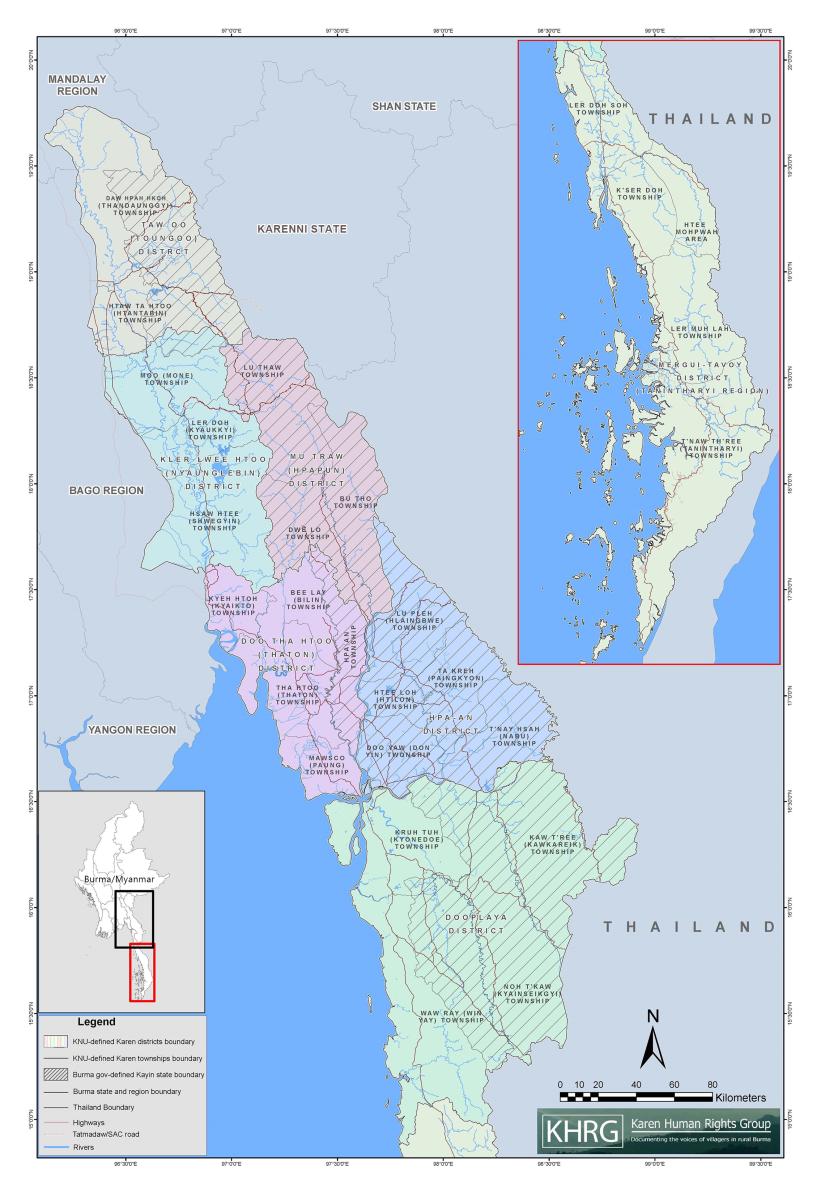
Karen State, defined locally, includes the following areas: Kayin State, Tanintharyi Region and parts of Mon State and Bago Region. Karen State, located in Southeastern Burma, is primarily inhabited by ethnic Karen people. Most of the Karen population resides in the largely rural areas of Southeast Burma, living alongside other ethnic groups, including Bamar, Shan, Mon and Pa’O.
KHRG operates in seven areas in Southeast Burma: Doo Tha Htoo (Thaton), Taw Oo (Toungoo), Kler Lwee Htoo (Nyaunglebin), Mergui-Tavoy, Mu Traw (Hpapun), Dooplaya and Hpa-an. When KHRG receives information from the field, it organises data according to these seven areas. These are commonly referred to as ‘districts’ and are used by the Karen National Union (KNU), as well as many local Karen organisations, both those affiliated and unaffiliated with the KNU. KHRG’s use of the district designations in reference to our research areas does not imply political affiliation; rather, it is rooted in the fact that many rural communities commonly use these designations. For clarity, the Burmese terms for these districts are provided in brackets but do not correspond with the Burma (Myanmar) government administrative divisions.